Brilliant Maps
Making Sense Of The World, One Map At A Time

Star Trek Map Of The Alpha & Beta Quadrants
The map above is Shakaar’s Alpha/Beta map v3.3; a fan-made creation showing the Alpha and Beta quadrants of the Star Trek universe.
The map shows both major and minor powers that have appeared in the various series over the years.
At the centre is the United Federation of Planets, which borders the major power of the Klingon Empire, Roman Star Empire and the Cardassian Union. More minor powers include the Breen, Ferengi Alliance, Tholian Assembly, Sheliak Corporate and the Gorn Hegemony among many, many others.
The map highlights:
- Principal Systems
- Minor Systems
- Non-Aligned Systems
- Dead Systems
- Government Borders
- Points of Interest
- Navigation Hazards
- Star Clusters
- Stations or Starbases
For more Star Trek maps see:
- Star Trek Stellar Cartography: The Starfleet Reference Library
- Star Trek Star Charts: The Complete Atlas of Star Trek
- Star Trek Maps
Enjoy this map? Please help us by sharing it:
Get Our Latest Brilliant Maps Weekly:
Other popular maps.
European Capitals By Coats of Arms (City Emblems)
Jedi Knight Population Of The UK
The World’s Population In 1900 Looked Very Different Than Today
The True Size of Africa
Map of The Soviet Gulag Archipelago 1923-1961

Jewish Population of Europe in 1933 and 2015
Potential EU Exit Names For The 27 Remaining Member Countries
Hilariously Bad Attempts By Americans to Draw Europe From Memory, With an Unexpected Twist
December 13, 2017 at 8:14 pm
I know that: a) it’s a bit of fun b) it’s hard to make a 2d map of 3d space and c) there no official maps to go off
But Christ, there’s a lot of stuff on here which makes no sense.
Justin Spaulding says
September 7, 2019 at 2:36 am
Isn’t gamma haromi 2 supposed to be in the haromi cluster…. Good effort though! S3. E8 I think. The “gatherers”
Danny Beans says
November 11, 2019 at 11:18 pm
Why are Ceti Alpha V and Ceti Alpha VI in completely different sectors? I mean, okay, Chekov can be a little dumb sometimes, but that’s one helluva mistake to make.
Jadziah Dax says
April 7, 2021 at 6:03 pm
Can’t wait to see the one you do!
petewinsemiusyahoocom says
November 23, 2022 at 3:47 pm
I agree, several planets said to be in the alpha quadrant are in the beta quadrant and vice versa or not listed at all.
Resolute_Phoenix says
February 8, 2018 at 11:41 pm
Okay so Xindus by Vulcan…. kys I’m not even gona bother looking further don’t make a map if you don’t know what your talking about
February 18, 2019 at 9:03 pm
Romulons should have Dyson sphere (at least at Romulus and Remus). Their ship tech is based on creating black holes which will give a ship a reactor core with a life of a handful of years BUT it’s just like an inefficient battery because it takes way more energy to initially create it then it will give off over its life BUT it’s portable. Sure beats light sails if your depending on home system energy and way more flexible too. This was their tech wheelhouse, and was their interstellar travel energy source instead of antimatter. It makes total sense for them to have harnessed the majority of their native suns energy to create reactor cores wherever they needed a portable energy that couldn’t tap into the system wide grid.
February 22, 2019 at 9:26 pm
A few questions… 1) Why are there several Indus VIII on the map?, 2) I do not see the First Federation on this map — they should be near the Ferengi!, 3) Where is the Kelvin planet? (The planet colonized by the Kelvins from “By Any Other Name”), 4) Maybe I’m wrong, but I do not see the Dyson Sphere that TNG crew ran into?
Shane Montgomery says
March 4, 2020 at 10:25 pm
I don’t see Barzan II or the Barzan Wormhole here?
Pickard says
January 23, 2021 at 3:39 pm
They are there. Literally the only Dyson sphere symbol near the bottom.
August 6, 2019 at 5:03 pm
Spock: He is intelligent, but not experienced. His pattern indicates two dimensional thinking.
Glenn Bryson says
November 15, 2019 at 6:52 pm
Not your fault, I know;
Vulcan is “Supposed” to be “A little over sixteen” light years from earth. Yet the map has it at around 1000. That’s one of my biggest gripes about Star Trek (I absolutely love Star Trek, don’t get me wrong). Distances and travel times are so inconsistent and unrealistic based on the documented scales, maps, etc.
March 14, 2020 at 11:46 pm
Did you mean Starbase 375 instead of 395? As in the starbase from S6 of DS9 after the Dominion took over the station?
Avro Arrow says
March 24, 2020 at 7:04 pm
I love this map, especially how you have the Hydran Kingdom, the Lyran Star Empire and the Kzinti Hegemony are listed (where is the Interstellar Concordium?). I have one small nit-pick to make and that is you have two systems named “Nelvana III”. They’re both in the upspin Beta quadrant but one is in the Romulan Neutral Zone and the other is further upspin and outward (left). I think that you might consider making most of the empty space that is coreward of Klingon and Romulan space into the ISC. They were referred to as being a Galactic Superpower residing on the far side of both those Empires (so, coreward).
Gray.Elton says
May 19, 2020 at 3:21 am
If we do or don’t do it, someone will laugh
July 15, 2020 at 1:53 am
I dont understand how this can be called a map of the star trek galaxy when there isnt even a spot or indication of where earth is. Who makes a map without earth when you have a series where its location is based on earth. In the series they refer to Earth as Earth. Yet the closes thing to it is on the map is Volcan. Y not add Earth as well? If there is an alternative name how come it’s never mentioned in the shows and a secret for fans?
Brandon says
August 15, 2020 at 4:14 pm
Earth is 100 percent there. It’s Sol. It’s a common alternate name for our star system and has been used in Trek.
February 8, 2021 at 3:26 pm
Sol system. The Greek word for sun. Follow the bold line and look for the team Terran and Vulcan sectors. Sol is on the 4 corners there
May 23, 2021 at 11:35 pm
Cheron is not in the Romulan sphere of influence. It is located in the “Southern most part of the Galaxy”, Captain Kirk. Episode “Let That Be Your Last Battlefield”
That dude says
September 6, 2021 at 5:31 am
Issues: Tykens rift, not Titans. Starbase 47 is about 10 sectors off as memory Beta says it is located between the Tholian assembly and the Klingon empire. Prophets Landing is in the gamma quadrant.
That’s all for now!
That Guy says
May 17, 2022 at 11:20 pm
Alpha Onias III is on here multiple times
John S says
November 16, 2022 at 4:31 am
Don’t the Klingon and Cardassian Empires border each other? A lot of DS9 s4 doesn’t make sense if they don’t…
martijn says
March 18, 2023 at 11:16 pm
where is earth ?
Leave a Reply Cancel reply
Your email address will not be published. Required fields are marked *
This site uses Akismet to reduce spam. Learn how your comment data is processed .
Star Trek : Map
The following pictures are a selection of official or real maps taken from books, CD-ROMs and the internet. Please click on the label between the picture or on the picture itself with the right mouse button and then choose 'Save target as' from the context menu to download it.
Official Star Trek maps
Back to the Star Trek Cartography overview
� 1999-2001 by Star Trek Dimension / Webmaster . Last update: April 29th, 2001
Screen Rant
Star trek's 4 quadrants & galaxy explained.
Along with the Milky Way Galaxy's quadrants, the Star Trek universe encompasses galactic barriers, further galaxies, and even a mythological core.
Most of the action in Star Trek takes place in the real-world Milky Way Galaxy which is roughly divided into four quadrants, named after the first four letters of the Greek alphabet: Alpha, Beta, Gamma, and Delta. These are the galactic regions that include significant planets like Vulcan, Qo'noS, and of course, Earth. While Gamma and Delta still bear planets with ominous origins, the Alpha and Beta Quadrants are perhaps touched upon the most within the Star Trek mythos. Despite this common division, The Next Generation also referred to a new quadrant known as Morgana. But not much is known about this certain quadrant as it is not mentioned any further.
Even beyond the Quadrants, ardent Star Trek fans can spot the Galactic Barrier and several other celestial objects that are present in other galaxies like the Andromeda Galaxy (yet another real-world phenomenon) that are still yet to be explored more by the franchise's protagonists. While most of these galactic quadrants can be seen as astronomical phenomena rooted in scientific explanation, the mythos can also incorporate near-godly beings like the Sha Ka Ree in regions such as the so-called "Great Barrier." The two Barriers carry within them such heavenly mysteries that deserve explanations of their own.
TOS Invented Star Trek's Best Time Travel
Alpha Quadrant
The Star Trek galaxy explained that the Alpha Quadrant contains more than 60 home worlds, and this includes Captain Kirk's home planet Earth itself (which Trekkers would call Terra or Sol III). Other major planets include the Tellarite native planet Tellar Prime, Trill, which houses both the eponymous humanoid species and the non-humanoid Trill symbionts, and Betazed, which is inhabited by the Betazoids, a humanoid species that boasts warp-capable space vessels. Even though the majority of territories under the Klingon Empire and Romulan Star Empire fall in the Beta Quadrant, the two forces join the United Federation of Planets and the Cardassian Union to constitute the four great powers in the Alpha Quadrant in the late 24th century.
Beta Quadrant
The Star Trek galaxy explained that apart from the Romulans and the different versions of the Klingons , the Beta Quadrant's highlight is Vulcan, the native planet of Spock and other members of the Vulcan species. Multiple Star Trek encyclopedias suggest that Vulcan is located in a Sector of the same name within the Beta Quadrant. The 2002 publication Star Trek Charts also estimates Vulcan's exact position to be somewhere in the 40 Eridani star system that really exists 16.3 light years from Earth's Sun. Much like Spock, the inhabitants of Vulcan can be identified with their raised eyebrows and pointy ears. Mostly devoid of emotions, the Vulcans are known for leading a life on the basis of logic and reasoning.
The Klingon homeworld Qo'noS and the Romulan Empire's native planet Romulus also fall under this galactic quadrant. The former has a chaotic weather system with frequent thunderstorms and a rocky landscape characterized by numerous dormant volcanoes and caves. The native warrior species of Klingon are bound by their martial traditions and value honor in combat. As for Romulus, the planet served as the second home for Romulans ever since they migrated from Vulcan. The biological cousins of the Vulcans, they had to move back to their original homeworld after Romulus' sun exploded in 2387. According to The Next Generation , Risa is also a part of this quadrant. Known as the pleasure planet, Risa is known for its sexually liberated culture.
Gamma Quadrant
The Star Trek galaxy explained that the Gamma quadrant includes several Star Trek planets such as Brax, Yadera, Meridian, and others. As seen in Deep Space Nine , the Quadrant also houses the Dominion, an aggressive ensemble of several alien species commanded by the shape-shifting Changelings (AKA the Founders). Several territories of the quadrant are under the Founders' control even though they have had only two home worlds. The first home world of the Founders was a rogue planet that housed the Founders who were, at that time, escaping prosecution from the "solids" (how they referred to non-shape shifters). By 2372, the Founders shifted to a second home world.
Related: Star Trek - Spock's Entire Prime Universe Timeline, Explained
Delta Quadrant
The Star Trek galaxy explained that Star Trek: First Contact confirms the origin of the Borgs from Delta but doesn't name their home planet. This is the case for many other species of Delta, a quadrant that is relatively unexplored by the United Federation. Only Voyager offers the most details about the planets within the quadrant. Delta is also known as the domain of antagonistic species like the Borgs, the Kazon, and the Vidiians. The cybernetic Borgs are mostly linked through a hive mind known as the Collective. As for the Kazon, they are nomadic in nature which makes it difficult to trace their planet. Vidiians are similarly migratory and sport-scarred faces as a result of the terrible Phage pandemic.
The Galactic Barrier
The Star Trek galaxy explained in the original series what is known as Star Trek 's Galactic Barrier . In the subsequent years, Trekkers have called it by many names ranging from Great Barrier to the Energy Barrier, but there is still much debate and discussion regarding the origin of this energy field that surrounds the Milky Way Galaxy. The origins behind its creation are still hotly debated so it is uncertain whether the Galactic Barrier was created by a natural process or by artificial means. Most of the conventional spaceships that have tried crossing this barrier in the Star Trek universe have often been destroyed with the crew even gaining psychoactive traits while nearing the barrier.
The Andromeda Galaxy
Progressive exploration of the Star Trek galaxy explained that the Milky Way Galaxy is definitely not the final frontier , as several other galaxies lie beyond it, such as the Andromeda Galaxy. This serves as a home for the planet Kelva, the capital of the Kelvan Empire. The Kelvans are highly intelligent shapeshifters. Because of their intellectual superiority, the Kelvans feel that it is their duty to rule over other species. The same galaxy also includes the humanoid species simply known as the Makers, creators of service robots and outposts in both the Andromeda and Milky Way Galaxy. The outposts were a residential necessity given how a supernova had destroyed their homeworld.
The Extragalactic Species
The Star Trek galaxy explained that the spanning areas of planets and species that border Star Trek 's Galactic Barrier from the galaxies beyond the Milky Way are still vague in Star Trek canon. Still, some information has been obtained on a few humanoid and non-humanoid extragalactic species. Species 10-C is a major case in point. A highly-advanced non-humanoid race with members much larger than humans, the species is responsible for creating the heavily destructive Dark Matter Anomaly. With their bodies adapted to float in gas layers, Species 10-C belong to a homeworld near the Galactic Barrier. Other such examples of extragalactic species include the "space amoeba" Nacene, the physically fragile Ornithoid, and immortal races like the Q and the Douwd.
Related: Star Trek Just Created A Second 25th Century Timeline
The Center Of The Galaxy
Star Trek V: The Final Frontier reveals the presence of the mythological planet Sha Ka Ree right at the center of the galaxy that doesn't fall under any quadrant. An equivalent of the concept of heaven, Sha Ka Ree is regarded in Vulcan mythology as the realm of all creation. But owing to humankind's fear of exploring the unknown and the second Galactic Barrier, the exact physical nature remains unexplored and is regarded as a mythical entity. It goes to prove how the mysteries of Star Trek 's chief galaxy don't just go beyond its exterior but its very core too.

Multiple Alternate Realities And Timelines
Not only is there several quadrants, but the Star Trek galaxy explained that there are also several alternate timelines in the franchise's world. In the Paramount+ series Picard , there is an alternate reality that completely rewrites Star Trek's history . The movies, from the original series to the Next Generation, take place in what is known as the Prime Universe. The J.J. Abrams movies take place in what is known as the Kelvin Timeline.
Abrams showed this in his movies by having the Kelvin Timeline Spock meet a Spock from a different timeline. This allowed Star Trek to move on with any story it wanted to tell by explaining the characters are from different timelines with new and fresh histories. There is also a Mirror Universe, an alternate timeline ruled by the fascist Terran Empire instead of the Federation. With so many quadrants, they all likely ended up very different in each timeline, making the Star Trek stories endless.
More: Why TOS Never Got A Series Finale Until Star Trek VI
- Movies & TV
- Big on the Internet
- About Us & Contact

A Wannabe Blue Shirt Officer’s Guide to the Map of the Galaxy in ‘Star Trek’
No matter the fictional universe— be it fantasy or sci-fi or somewhere in between (looking at you, space operas)—I’ve always found maps and cartography one of the most fascinating parts of worldbuilding. There’s something about actually seeing how an author imagines the setting of their story that immediately grounds it in the realm of possibility, and helps immerse viewers in the worlds in which these stories unfold.
Sure, it’s somehow easier when the map consists of a single continent, kingdom, or city on Earth or any other Earth-like location. Bringing the action up into space definitely makes everything a tad more complicated—and a whole lot more fascinating.
And now that the third season of Star Trek: Picard is in full swing , there’s no better time to refresh our collective memory on the “astrogeography” the crews of the USS Enterprise explore.
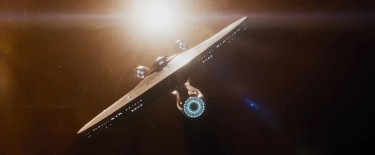
Star Trek and maps
The decades that have passed since Star Trek first premiered on television screens have made it possible for the saga to acquire beautifully complex and detailed lore on pretty much everything related to it—including the planets that make up the United Federation of Planets, and the powers that border it, like the infamous Klingon Empire.
There have actually been several maps made for Star Trek and its locations over the years, as it reads on The Map Room blog . “While original series canon assigned aliens to known nearby stars, and the shows occasionally used real locations, episode writers did not start with a map and generally did not take spatial relationships into consideration, which no doubt has made the belated mapping process a bit more challenging,” The Map Room blog continues, explaining how creating a comprehensive map of the Star Trek galaxy might be easier said than done.
Still, while none of the maps ever put to print or screen have ever been accepted as official canon, most of them have the major power players of the galaxy in more or less the same location. This means we can reasonably assume that this is the actual position in which they can be found in-universe.
The galaxy quadrants
Most of the action in the Star Trek canon takes place within our galaxy, the Milky Way, which has been divided into its famous four primary quadrants, each named after a letter in the Greek alphabet: Alpha, Beta, Gamma, and Delta.
The Alpha and Beta quadrants are the ones that are better known, even in-universe, and that house many of the major players we see throughout the various series—the United Federation of Planets chiefest of all. The Federation has a strong foothold in both quadrants, spanning Alpha and Beta from their shared border outwards.
According to Memory Alpha , the official Star Trek fan wiki, the Alpha quadrant contains two all-important planets that we all know very well: Earth, from which a good majority of the characters in Star Trek canon hail; and Vulcan, the homeworld of the Vulcans and especially of Spock. This quadrant also contains the Cardassian Union, the Ferengi Alliance, and the Breen Confederacy—among other smaller factions—whose representatives make an appearance in the canon, particularly in Star Trek: Deep Space Nine .

The Beta quadrant includes a couple of relatively smaller players like the Nyberrite Alliance and the Tholian Assembly, and then the major forces of the Romulan Star Empire and the infamous Klingon Empire—who both have their respective homeworlds, Romulus and Qo’noS, in this quadrant.
In contrast to the Alpha and Beta quadrants, the Gamma and Delta quadrants are considerably less well-known and less visited—which makes sense, considering the notable distances that separate them from the other areas of the galaxy, which would require years to bridge even at warp speed. Their reputation also isn’t as stellar as the areas in Federation space.
Still, they are of course mentioned time and again in the canon, as are the planets and people located within them. The Delta quadrant, for example, is the place of origin of the infamous Borg Collective, made up of the terrible Borg cyborgs.
(featured image: Paramount+)

The Map Room
Mapping Star Trek
This month marks Star Trek ’s 50th anniversary, so I thought it might be worth it to put together a little post about maps in Star Trek . This proved to be more fraught a subject than I expected. There are a lot of maps of the Star Trek universe out there by divers hands, some more official than others, and they don’t always agree on all points, as Sufficient Velocity forum member WhiteDragon25 griped in 2014 :
Despite so many planets, stars, systems, and other locations that were mentioned and referenced to throughout the entire franchise’s run, we’ve never got an official and fully accurate map of the Trek universe. […] Hell, for all of the Star Wars EU’s faults, at least it managed to generate a universally accepted map! Star Trek on the other hand, despite being just as popular as Star Wars, cannot even figure out the sizes and positions of the Feds, the Romulans, and the Klingons in relation to one another!
WhiteDragon25 might be overstating things a bit: most of the maps have the Star Trek major powers in the same relative position (other empires like the Tholians are another matter). But the point remains. While original series canon assigned aliens to known nearby stars, and the shows occasionally used real locations (e.g. Wolf 359 ), episode writers did not start with a map and generally did not take spatial relationships into consideration, which no doubt has made the belated mapping process a bit more challenging.

In print form, the earliest map I’m aware of is Star Trek Maps (1980), which according to Memory Alpha was a pair of double-sided map posters accompanied by a fairly mathy booklet; of course, the Star Trek universe was a lot smaller then. Star Trek: Star Charts came out in 2002 and seems to be considered the most canonical of the maps in existence; it’s out of print now, though. Star Trek: Stellar Cartography (2013), a collection of ten 24″×36″ folded maps. (Note that I haven’t seen any of these maps.)

Online, Star Trek Dimension’s Cartography section has maps from the series as well as Christian Rühl’s Galactic Atlas . StarTrekMap.com , a fan site that appears to be based on Star Trek: Star Charts , uses an in-universe interface that functions well (scroll wheel zooming!) but is awfully small on large screens. Neither has been updated in years. The Star Trek Online game also has, as you might expect, a map .

Share this:
Related posts.
You must be logged in to post a comment.
Tabletop RPG Podcast and Roleplaying Resources
- Saturday Night Dice
- Heroes of Arnor Campaign Overview
- Session & XP Logs
- Map: Arnor in the 1640s
- Map: Environs of Elnost
- Resources & Best Practices
- Rules Q&A
- Organized Play
- Level Tracking
- Key D&D Rules Q&A
- Player Codex (Google Doc)
- Cheat Sheat: People, Places, & Things
- Adventure Log
- Campaign Charter
- Campaign Map
- Legends of Redmark
- Western Reach
- Saltshore Islands
- Oskarrian Archipelago
- Hex & Region Write-ups
- Cast of Characters
- Character Creation
- Campaign Overview
- House Rules
- Season 1 Characters
- Session Logs & News
- Stardates and Timeline
Star Trek Galactic Map
- The Taurus Reach and Starbase 47 (Vanguard)
- Podcasting Best Practices
- 50 Fathoms- Campaign Charter
- Lore of the Atani
- Father Rodrigo Torquemada Salvatore
- Liam McCormic
- Mordecai Boon
- Map of Caribdus
- General Locations
- Notable NPCs
- Cypher System Resources
- Eilar Character Sheet
- Skirmish Debriefs
- Adventure Logs & Crawls
- Star Wars XP Log
- People, Places & Things
- Campaign Overview & House Rules
- Arkanis Sector
- Key Star Systems
- Rel Thaxton
- Adventure Logs
- Reich America
- Iron Oak Saga
- Dwellers(PCs)
- Setting Aspects
- Castle Matos
- Flining ‘Flin’ Parthad
- Philip Windsor
- Samson “Sam” Roth
- People, Places and Things
- SS Behemoth — Campaign Map
- Traveller Links & Resources
- Leviathan: Campaign Overview & House Rules
- Leviathan: XP Log
- The Neutron Star Directive
- Favorite RPGs
- Battlemat Suppliers
- Wargames Articles
- Wargames Roadmap
- 15mm Miniatures Resources
- Starship Miniatures
- Sword and Spear Resources
- Skirmish Movement Trays
- Stan’s Reading Lists
- Board Games
- Flickr Photos
- Conventions
Here’s the current map of Star Trek Federation Space and the Taurus Reach I’m using. I might make my own at some point.
Download the full Galaxy Map PDF (9 Meg).
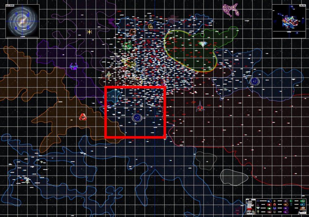
The Taurus Reach
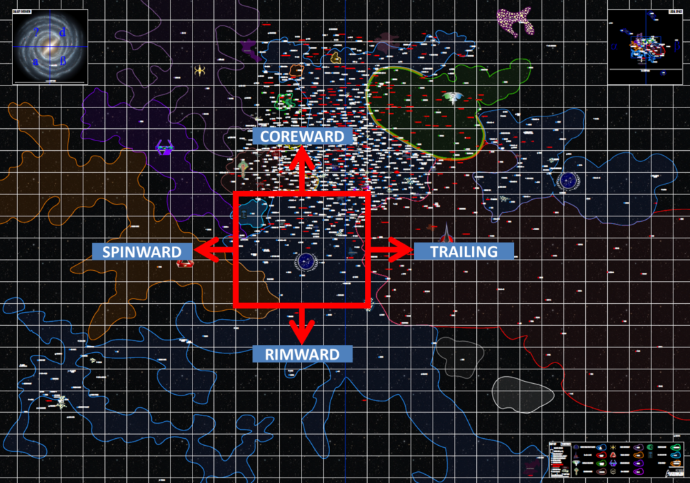
Galactic Map Directions
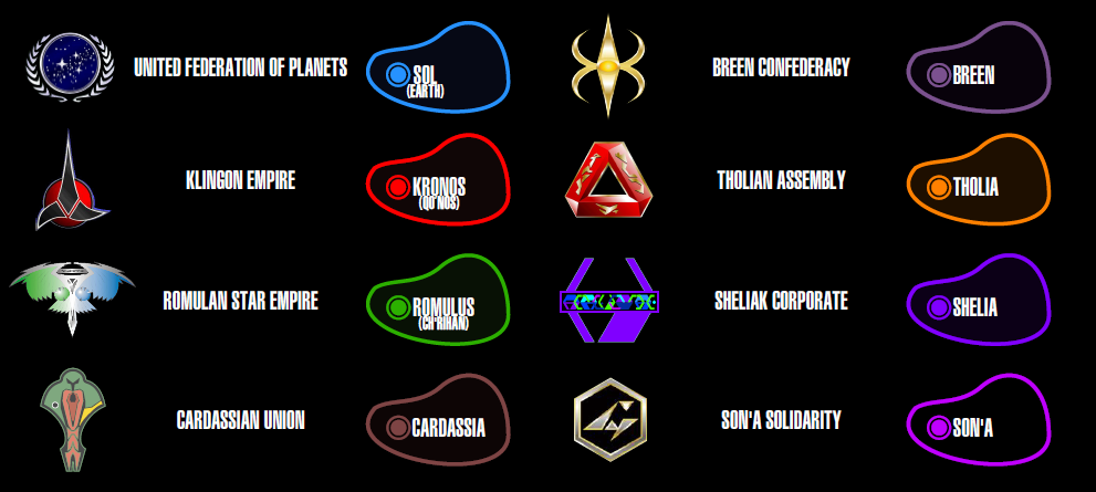
Galactic Territories
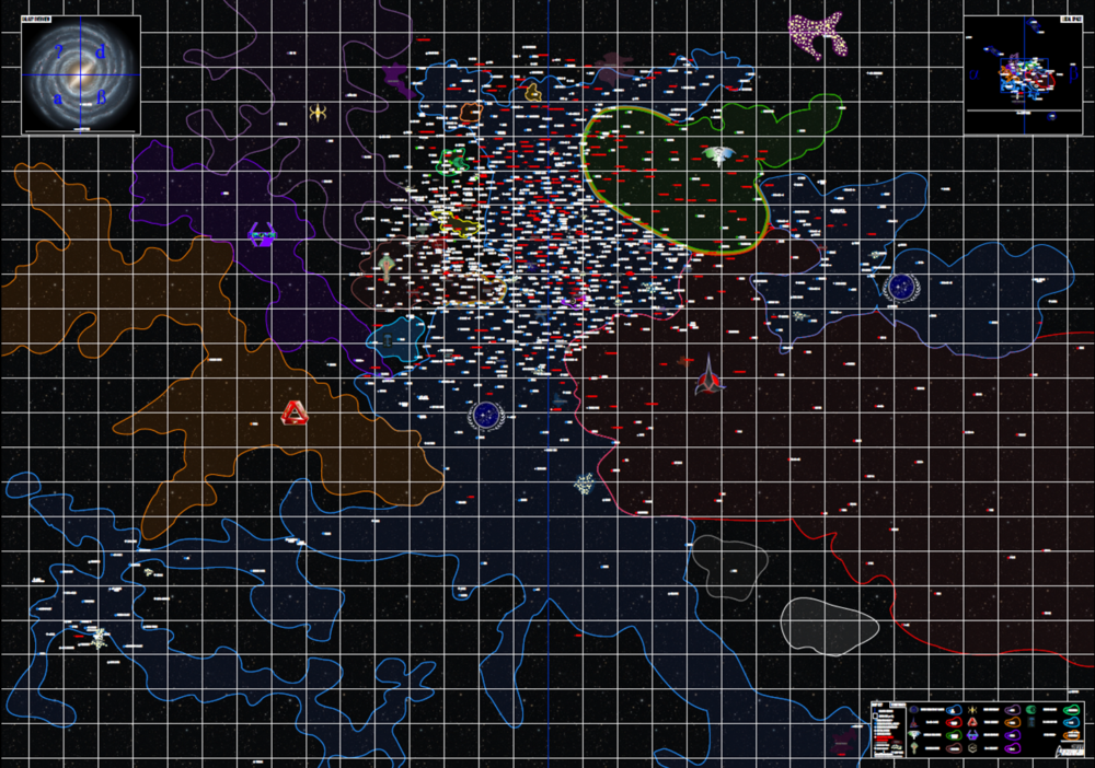
Galactic Map
Dicehaven Podcast

Dicehaven is an actual play podcast featuring various tabletop RPGs. We’re currently playing Imperium using the Traveller RPG (Mongoose 2nd Edition).
Listen now to our first episode.
Listen to us on iTunes, Spotify, and other platforms (links are at anchor.fm/dicehaven ).
Follow our Instagram posts at instagram.com/dicehavenpodcast .
Hello and welcome to Dicehaven! We are a game club in the DFW area who play tabletop roleplaying games. Check out our RPG podcast and our musings and resources on roleplaying.
Recent Comments
- Stan Shinn on Top Stuff I Want To Run Someday (Late 2023 Edition)
- Gary Fredrick Furash on Top Stuff I Want To Run Someday (Late 2023 Edition)
- Stan Shinn on Running Old-School Modules as Backup Games
- James Tate on Running Old-School Modules as Backup Games
- Musings on The One Ring 2e for a Saturday Campaign – Dicehaven on The One Ring 2e Online Dice Rollers
- Entries feed
- Comments feed
- WordPress.org
© 2024 Dicehaven
Theme by Anders Noren — Up ↑

Star Trek Maps
The navigational charts of the five-year voyage of the Starship Enterprise Four deluxe wall maps suitable for framing in stellar four color, pinpointing all the Federation Planets, Neutral Zones and beyond. Plus: Official 32 page Technical Manual

Federation star charts
- View history
A star chart of the Milky Way Galaxy
The Federation star charts were a collection of star charts , including all pertinent information about the star systems visited by Federation probes and starships .
In 2269 , the USS Enterprise was on outward course beyond the fringe of the galaxy , near Questar M-17 on a star charting mission. ( TAS : " Beyond the Farthest Star ")
In 2370 , the USS Enterprise -D investigated a rogue comet in Sector 1156 that was not on Federation charts. ( TNG : " Masks ")
- 1.1 Beta Quadrant
- 1.2 Enterprise long range scan, 2259
- 1.3 Map of the Federation, 2383
- 1.4 Commander-in-Chief's office, 2399
- 2 "The Explored Galaxy"
- 3 Library computer star charts
- 4.1 Alternate timeline, 2404
- 5 32nd century galactic map
- 6 Path of the DMA
Alpha/Beta Quadrant Overview [ ]

Alpha/Beta Quadrant Overview star chart
The star chart following the Klingon takeover
The Alpha/Beta Quadrant Overview star chart was first seen in 2256 , in Captain Lorca 's quarters aboard the USS Discovery , as well as at Lieutenant Rhys 's station on the bridge. It displayed the location of the Discovery near the Federation-Klingon border during the Federation-Klingon War of that year .
It shows the locations of the Alpha Quadrant systems Aldebaran (Alpha Tauri), Amar , Andoria , Azha (Eta Eridani), Ba'ku , Beta Leonis Minoris ( Beta XII-A ), Beta Rigel , Castor (Alpha Geminorum), Coridan (Chi 1 Orionis), Deneva (Kappa Fornacis), Elora , Orion , Organia , Pollux (Beta Geminorum), Risa (Epsilon Ceti), Son'a , Tarlac , Tellun ( Elas Troyius ), Vulcan , Zibal (Zeta Eridani), and 11 Leonis Minoris , as well as the Briar Patch , Sherman's Planet , and Starbase 12 (Gamma 400). Amar, Organia, and Sherman's Planet are indicated to have been Klingon Empire territory at the time.
Beta Quadrant systems on the Federation side of the border include Acamar (Theta Eridani), Adelphous , Ajilon ( Tananda Bay ), Alpha Onias , Barolia (Wazn, Beta Columbae), Beta Pictoris , Carraya , Celes (Tau Hydrae), Chi Leonis , Galorndon Core , Gamma Hromi , Hyralan (Alpha Caeli), Japori (Beta Caeli), Jouret (New Providence), Miridian , Omega Leonis , Ramatis , Regulus (Alpha Leonis), Tomed , Unroth , Xarantine (Zeta Leporis), and Yridia . Landmarks on the Federation side include the Azure Nebula , Deep Space Station K-7 , the Hromi Cluster , the Paulson Nebula , Starbase 23 , Starbase 24 , Starbase 157 , Starbase 234 , and Starbase 343 .
Beta Quadrant systems on the Klingon Empire side of the border include Archanis , Archer , Ardana (Rasalas, Mu Leonis), B'Moth , Balduk , Beta Lankal , Beta Penthe (as Rura Penthe ), Beta Thoridor , Brestant (Delta Laporis), Cursa (Beta Eridani), D'deridex , Dewa , Dinasia , Gamma Eridon , Ganalda , Gasko , Gorath , H'atoria , Halee , Iccobar , Iconia , Ikalia , K't'inga , Khitomer , Klach D'kel Brakt , Korvat (Pi Canis Majoris), Krios , Lambda Geminorum , Mempa , Morska , Narendra , Nequencia , No'Mat (Omicron Leonis), Pheben , Praxis , Qo'noS (Kronos, Kling), Qu'Vat , Tranome Sar , and Valt . The star Archanis is right on the border, while Gasko and Korvat are shown as being under Klingon control, but on the Federation side of the border. Archanis and Korvat are on the Klingon side of the thinner dotted line, however.
Beta Quadrant [ ]
A star chart of the Federation/Klingon border, 2256
This Beta quadrant star chart focused on the regions of the Hromi Cluster , the Archanis sector , the Briar Patch and the Paulson Nebula . It was on Gen Rhys 's display while the USS Discovery jumped out of Klingon space while saving Captain Gabriel Lorca . ( DIS : " Choose Your Pain ")
Enterprise long range scan, 2259 [ ]

A star chart displaying warp capable civilizations near Kiley space, 2259
In 2259 , Lieutenant Spock brought up a star chart of Federation space before focusing on local space around the Kiley system to show that development of warp drive was much more common before development of a warp bomb . ( SNW : " Strange New Worlds ")

Map of the Federation, 2383 [ ]

A star chart aboard the Protostar in 2383
In explaining the Federation to the new crew of the USS Protostar , the holographic training advisor Kathryn Janeway brought up a holographic star chart, depicting Federation, Klingon, and Romulan space. Portions of the map were labeled Andorian , Cabral , Maxia , Melona , Mutara , Terran , Vulcan , Tellarite , Yadalla and Zalkon . ( PRO : " Starstruck ")
Commander-in-Chief's office, 2399 [ ]
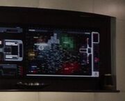
A star chart displayed in Clancy's office, 2399
In 2399 , Fleet Admiral Kirsten Clancy had an Alpha / Beta Quadrant overview star chart depicting local galactic powers displayed on her wall when Jean-Luc Picard came to see her. Entities depicted included the Talarian Republic , the Cardassian Union , the Romulan Free State , the Ferengi Alliance , and the Klingon Empire .
Each square on the map was just over 15 light years across, according to notation on the chart. The chart was over 345 light years across and over 195 light years top-to-bottom. ( PIC : " Maps and Legends ")
"The Explored Galaxy" [ ]
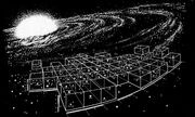
A star chart of the explored areas of the Milky Way Galaxy
The star chart of the explored space in the Alpha and Beta Quadrants depicted the home systems of the three great powers in the quadrant – the Federation, the Klingon Empire , and the Romulan Star Empire . Along with these systems, the home systems of several less significant powers – the Tholian Assembly , the First Federation , and the Kzinti – were, also, depicted on the chart. Many of the locations on this map were visited by the USS Enterprise during its historic five-year mission of the late 2260s . Developments in the 24th century , such as the expansion of the great powers into uncharted and charted space, reduced this chart to a historical relic by the 2370s .
In 2293 , the star chart of the explored galaxy was displayed in Captain Kirk 's quarters aboard the USS Enterprise -A . ( Star Trek VI: The Undiscovered Country )
The chart was also seen frequently in the 24th century in various locations. In 2364 , the chart was displayed at Starfleet Headquarters in the room where Dexter Remmick , possessed by parasitic beings , was killed after sending a homing beacon . ( TNG : " Conspiracy ") In 2365 , the chart was seen in the court room on Starbase 173 ( TNG : " The Measure Of A Man ") and the tactical room aboard the USS Enterprise -D, close to another map that depicted the whole Milky Way Galaxy. ( TNG : " The Emissary ") In 2367 , the chart was seen in the tactical laboratory of Enterprise -D. ( TNG : " The Mind's Eye ") In 2368 , in the ship's engineering laboratory . ( TNG : " The Game ") In 2369 and 2370 , the chart was seen in the classroom aboard Deep Space 9 , featuring the heading "The Explored Galaxy". ( DS9 : " In the Hands of the Prophets ", " Cardassians ")

Library computer star charts [ ]
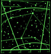
Several star charts appeared in the USS Enterprise -D library computer .

A star chart
A planetary system
A part of a planet
USS Voyager flight path [ ]
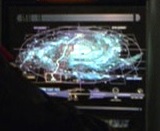
Voyager 's projected path home, 2377
In 2377 and 2378 , a star chart of the Milky Way Galaxy that projected the USS Voyager 's flight path to Earth was frequently displayed in astrometrics . It denoted the Alpha, Beta, Gamma, and Delta Quadrants, as well as the Carina Arm , Norma Arm , Crux Arm , Perseus Arm , Sagittarius Arm , Orion Arm , 3 kpc Arm , M14 , M80 , M92 , NGC 5139 , and the Bajoran wormhole . A timeline along the bottom noted Voyager 's trip beginning on stardate 48315.6, with markers at stardates 51003.7 , 52081.2 , 53061.4 , 54001.9 , and a projected return stardate of 92690.8 . ( VOY : " Inside Man ", et al.)
Alternate timeline, 2404 [ ]
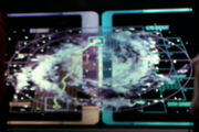
Voyager 's twenty-three year flight across the galaxy
In an alternate timeline, Voyager returned to Earth in 2394 , following a flight path that took 23 years. When Harry Kim would eventually be given command of the USS Rhode Island , he displayed a star chart of Voyager 's flight path home. ( VOY : " Endgame ")
32nd century galactic map [ ]

Burnham, Saru, Vance, Willa and Eli stand before a holographic star chart
In 3189 , Federation Headquarters prominently featured a holographic star chart of the Milky Way Galaxy.
It depicted known locations in all four quadrants, including: Andoria , the Ankari homeworld , Argus , B'Moth , the Brunali homeworld , Cardassia Prime , Cor Caroli V , Delta , the Devore homeworld , Doctari Alpha , Earth , Deep Space Outpost 36 , Deep Space Outpost 72 , Ferenginar , the Founders' first homeworld , the fourth Founders' homeworld , Halee , Inferna Prime , the Kazon Clan Forum , Morska , O'Ryan's Planet , Ocampa , Organia , Quarra , Rakhar , Talax , Tellar , the Valt system , and Zetar . ( DIS : " Die Trying ")
Path of the DMA [ ]
Commander Paul Stamets was analyzing information on the Dark Matter Anomaly in the Venari sector on a larger star chart when it abruptly disappeared, reappearing a few seconds later near Radvek V .
It labeled locations including Akaali , Altair , Andoria , Arcturus , Argelius , Barradas , Benzar , Bolarus , Calder , Celes , Cor Caroli , Deneva system , Denobula , Dessica , Devron , Draken , Draylax , Earth , Hyralan , Inferna Prime , Kaitos , Kaleb , Kelfour , Mab-Bu , Maluria , Memory Alpha , Nausicaa , Nelvana , Ni'Var , Ophiucus , Orion , Pollux , Priors World , Proxima , Pyrithia , Qualor , Rator , Rigel , Starbase 1 , Starbase 9 , Starbase 10 , Starbase 22 , Starbase 39 , Tagus , Tau Ceti , Tellar , Tellun , Teneebia , Toroth , Veda , Vega , Wolf 359 , Yadalla , and the Zetar system . ( DIS : " The Examples ")

- 3 Ancient humanoid

IMAGES
VIDEO
COMMENTS
The map above is Shakaar's Alpha/Beta map v3.3; a fan-made creation showing the Alpha and Beta quadrants of the Star Trek universe. The map shows both major and minor powers that have appeared in the various series over the years. At the centre is the United Federation of Planets, which borders the major power of the Klingon Empire, Roman ...
WELCOME TO STARTREKMAP.COM, The home of the stellar cartography for the Star Trek-Universe, based on the Star Trek Star Charts. This website is privately owned, non-commercial, unofficial, dedicated to the Star Trek-franchise and attempting to offer corrected and updated Star Charts for the known universe in the well-known LCARS-style.
Star Trek Stellar cartography (Star Trek Maps) downloads in PDF-format : Maps: Preview / download. Filetype / size. Description. License. 8,48 MB. Simplified map of the Federation Main Core and sourounding space as a searchable vector-PDF. ... Simplified map of the explored space in the 22nd Century, before the foundation of the Federation, as ...
Star Trek Maps is a set of four maps and an Introduction to Navigation booklet. Possibly the most technical Star Trek book ever produced, the booklet introduces the reader to galactic coordinates and basic vector calculus. The maps themselves are well researched and properly projected to 2D. The maps also include a list of Federation members and an overview of various planets visited in the ...
An overview of the entire galaxy. Gamma Quadrant. The Gamma Quadrant was first surveyed by the Quadros-1 probe, launched during the 22nd century. After initial discovery of the Bajoran Wormhole in 2369 extensive exploration began, which unfortunately also led to one of the most devastating wars in Federation history: The Dominion War. Local Space.
Map of the Galaxy Select a quadrant to view ... Buy the book at Amazon.com Star Trek Star Charts: The Complete Atlas of Star Trek ... Star Trek Star Charts: The Complete Atlas of Star Trek =/\\= Today is Stardate 77738.3 E-mail questions or comments ...
Star Trek : Map. Home Tools Star Trek : Map. Campaign Map: Off On Measture Tool: Off On Area Tool: Off On Distance. Warp Scale: Crusher TNG. Warp Factor. Engine Score. Power Requirement. Speed. Time. vpn_keyMap Key. The galaxy is divided into four quadrants (α, β, γ, δ), defined by two meridian passing through the galactic core. ...
Created: 8-3-1999. The Star Trek Cartography is the biggest source on information, data, programs and maps concerning the galactic geography in the internet. The mission of this project: to give the fans insight into the structure of the Star Trek universe for the first time, using all official facts, the episodes and the "real" astronomy in ...
Stellar Cartography: The Starfleet Reference Library is a licensed reference book and map set, written from an in-universe perspective by Larry Nemecek with art by Allie Ries, Ian Fullwood, and Geoffrey Mandel, and first published by becker&mayer! and 47North in December 2013. A second edition, released in October 2018 by Epic Ink, updates the set to include content from Star Trek: Discovery ...
Star Trek: Star Charts Atlas. This work is based on the recommended Star Trek Star Charts written by Geoffrey Mandel, with the help of Doug Drexler, Tim Earls, Larry Nemecek and Christian Rühl. The book is a guide to the known Star Trek-universe, featuring detailed maps and background information on the classification for stars and planets.
The spatial Star Trek universe: Space near Earth: The Romulan Neutral Zone: from Star Trek: DS9: from Star Trek Generations: from [TOS] Balance of Terror: taken from Sector 001, extended by Webmaster: prepared by Webmaster: taken from Star Trek in Sound and Vision: 1123 x 788 px, GIF, 148.0 KB: 360 x 304 px, GIF, 61.6 KB
The source at the moment is the official "star trek: star charts" and the star charts book as well as other almost-canon subregion maps. About historical data, I already have some info on the origins of the federation and canon evolution of the various powers. The Picard map is VERY interesting, from many points of view.
The Star Trek galaxy explained that the Alpha Quadrant contains more than 60 home worlds, and this includes Captain Kirk's home planet Earth itself (which Trekkers would call Terra or Sol III). Other major planets include the Tellarite native planet Tellar Prime, Trill, which houses both the eponymous humanoid species and the non-humanoid Trill symbionts, and Betazed, which is inhabited by the ...
A Wannabe Blue Shirt Officer's Guide to the Map of the Galaxy in 'Star Trek'. be it fantasy maps and cartography seeing. third season Star Trek: Picard full swing crews. Star Trek. Star Trek ...
ο Gruis, Latinised as Omicron Gruis, is a binary or triple star system in the southern constellation of Grus. It is faintly visible to the naked eye with an apparent visual magnitude of 5.52. Based upon an annual parallax shift of 32.50 mas as seen from the Earth, the system is located 100 light years from the Sun.
TORGA. TRIALUS (MERIDIAN) T-ROGORAN. VANDROS. WADI. YADERA. Global search for all locations in all maps.
Star Trek Maps is a reference work demonstrating the stellar cartography and navigation system featured on the Star Trek television series, written from an in-universe perspective. It was published by Bantam Books in August 1980, and licensed by Paramount Pictures.. The box set included four four-color wall maps, and an instructional booklet from the "Technical Publications Section" of ...
In print form, the earliest map I'm aware of is Star Trek Maps (1980), which according to Memory Alpha was a pair of double-sided map posters accompanied by a fairly mathy booklet; of course, the Star Trek universe was a lot smaller then. Star Trek: Star Charts came out in 2002 and seems to be considered the most canonical of the maps in ...
The Delphic Expanse, commonly abbreviated as "the Expanse", is the setting for the entire third season of Star Trek: Enterprise, first aired in 2003 and 2004.. The Expanse is about 2000 light years across, surrounded by thick thermobaric clouds.Its edge is located about 50 light-years from Earth.It is the home of the previously unknown hostile races collectively known as the Xindi, but the ...
Star Trek Fleet Command Galaxy Map v2.4.1 By: Originator: JoeCrash; New: TaggedZi - Server: [71] SoongOriginator: JoeCrash; New: TaggedZi - Server: [71] Soong
The Milky Way Galaxy is a spiral galaxy which is roughly 100,000 light years in diameter and is divided into four quadrants (α, β, γ, δ), defined by two meridian passing through the galactic core. Containing over 400 billion stars, only 23.25 out of 1,000,000 planets found in those star systems support intelligent life, which may develop a ...
Star Trek Galactic Map. Here's the current map of Star Trek Federation Space and the Taurus Reach I'm using. I might make my own at some point. Download the full Galaxy Map PDF (9 Meg). The Taurus Reach. Galactic Map Directions. Galactic Territories. Galactic Map. Print to PDF.
Star Trek Maps. The navigational charts of the five-year voyage of the Starship Enterprise Four deluxe wall maps suitable for framing in stellar four color, pinpointing all the Federation Planets, Neutral Zones and beyond. Plus: Official 32 page Technical Manual. This was one of the greatest treknology publications ever released.
Star Trek Fleet Command Interactive Map. A map made for Star Trek Fleet Command by Scopely.
This star chart can be seen in DIS: "Context Is for Kings" and every episode further episode of Star Trek: Discovery through "Into the Forest I Go".The map is derived from Star Trek: Star Charts (p. 63). Iconia is labeled on the map, however Iconia had not yet been rediscovered at the time of the Discovery. Several of the stars have their constellation's stellar Bayer designation given, such ...